The temperature during the month of January was a roller-coaster but precipitation was easier to track since there wasn’t much.
Environment Canada Meteorologist Danielle Desjardins says the month started colder than average followed by multiple days of back-and-forth changes in temperature.
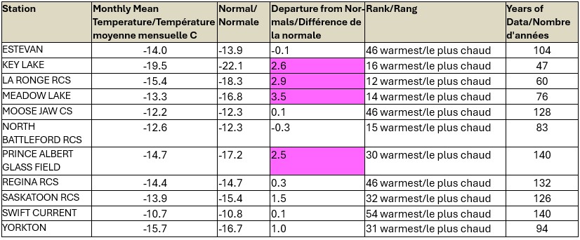
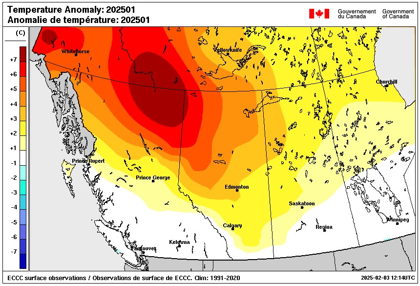
Despite that, Desjardins says the monthly averages at some weather stations including Moose Jaw, Regina, and Swift Current were near normal, while Yorkton and Saskatoon were one degree above normal. Northern stations at Key Lake, La Ronge, Meadow Lake, and Prince Albert were two degrees or more above normal.
The last 10 days of January ended up warmer than average, added Desjardins.
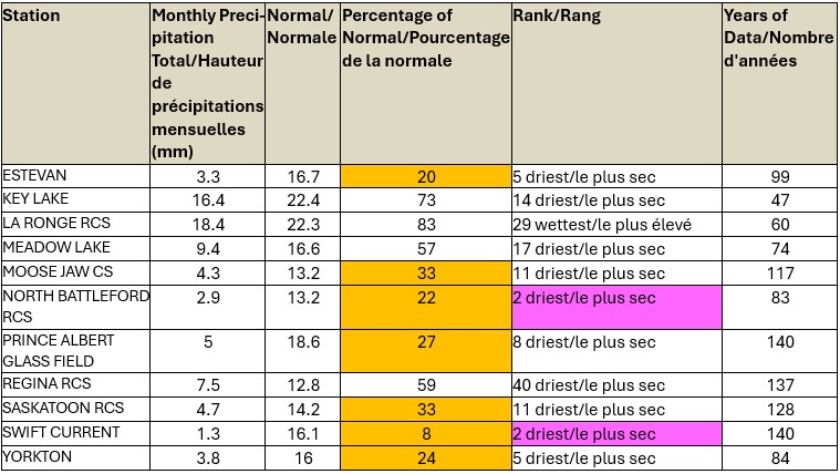
Precipitation during the month was below monthly averages for roughly half of the weather stations and a few above 50 per cent of normal.
“It’s kind of the opposite oft the temperatures where it looked like it was slightly above normal in the north, or nearing normal, but the south extremely dry.” she said.
North Battleford and Swift Current recorded their second driest month on record, respectively, while Yorkton had its fifth driest month. Regina, Meadow Lake, La Ronge, and Key Lake recorded over 50 per cent of normal levels of precipitation last month.

While most areas were fairly dry, Desjardins noted significant snowfall in the Cypress Hills area in the southwest “due to two prolonged heavy snowfall events.”